
Precision in Engineering Drafting, Excellence in Geospatial & Mapping Solutions
GeoPoint Solution is a global leader in Engineering CADAsbuilt Drawings, 3DModeling (BIM), LiDAR Data Processing, Geospatial, MappingandNavigation.With offices in USA, New Zealand, and India, we serve clients worldwide,delivering high-precision Geospatial Data Analysis and EngineeringDraftingsolutions that drive efficiency, sustainability, and cost-effectiveness.
Our expertise spans multiple industries, including Architecture, Engineering&Construction (AEC), Infrastructure, Utilities, Mining, RenewableEnergy,Transportation, Agriculture, Aviation, Location Based Services, UrbanPlanningand Smart Cities. By leveraging cutting-edge technology anddeepdomainexpertise, we transform complex spatial data into actionable insights.
Read More...
Services
We providing great Design Engineering & GIS Data Management services


150+
Projects
100%+
Satisfied Clients
20+
Expert Workers
10+
Years Of Experience
"Experience Our Complete
Process from Start to End – Ensuring
Quality and Precision Every Step of the Way."
Process from Start to End – Ensuring
Quality and Precision Every Step of the Way."
Survey
Gather precise data on the project site using advanced surveying techniques
Plan Analysis
Create a detailed plan that outlines geospatial elements and design requirements.
Estimate
Our experts will provide a quote tailored to your budget and project goals.
Crafting and Mapping
Once the plan and estimate are approved, relax as our team brings your vision to life with precision.
Delivered
Receive your comprehensive geospatial solution, fully equipped to support your project needs.
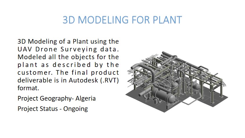
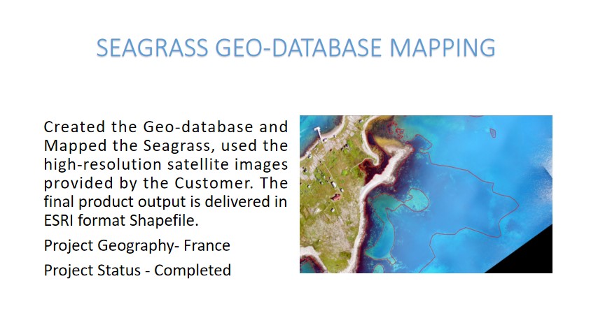
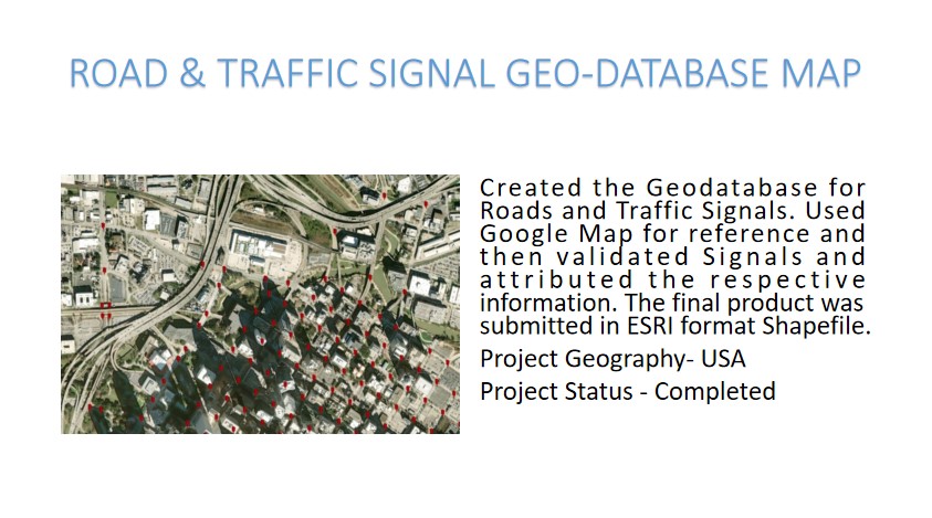
Our Projects
"Set your projects up for precision, optimized performance, and sustainable success—driven by expertise that ensures every detail counts."

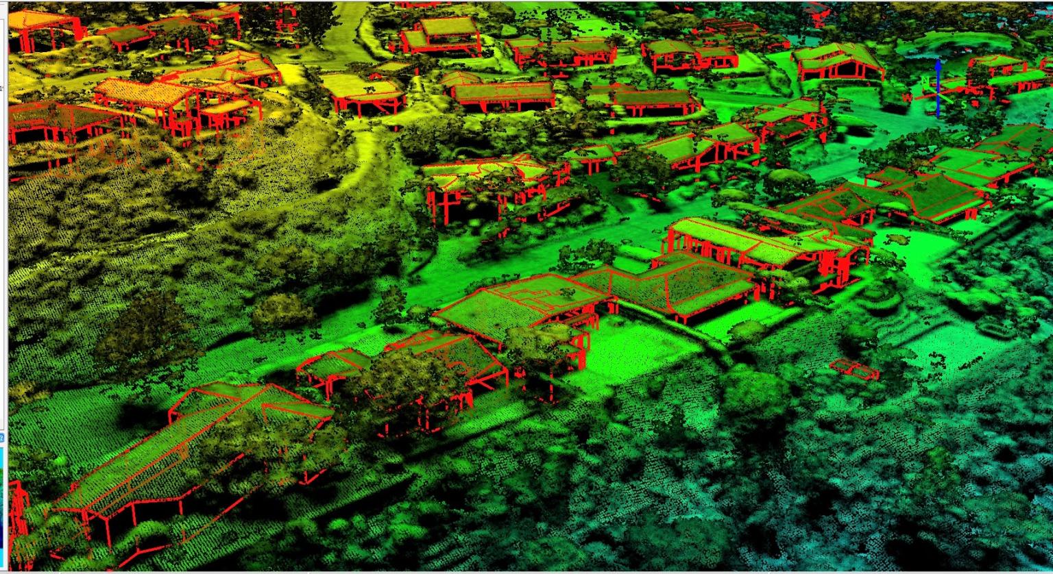
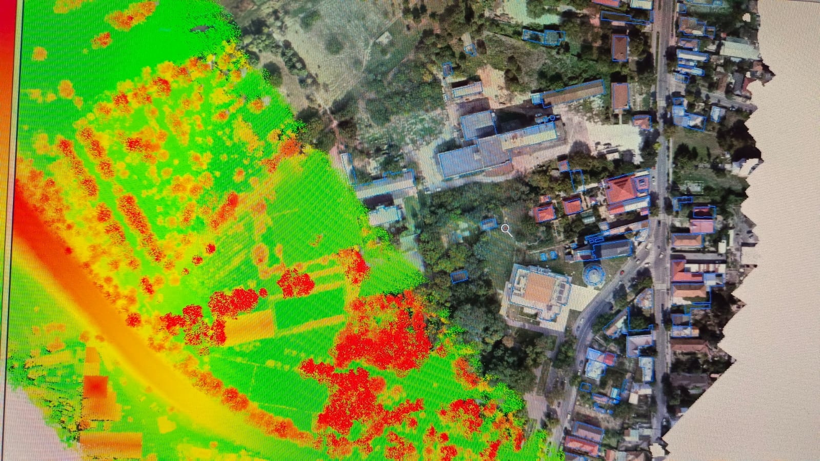
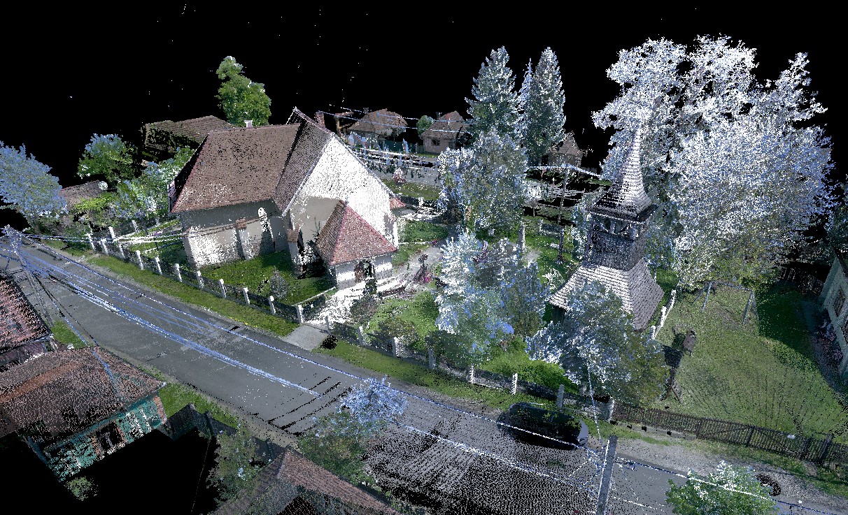
Comprehensive Geospatial Solutions: Design Engineering, Advanced Modeling, Precision Mapping, and Data Analysis
At GeoPoint, we serve a diverse array of clients and projects, delivering comprehensive geospatial solutions that elevate ordinary landscapes into extraordinary environments. Utilizing our expertise in Design Engineering, Modeling, CAD Drafting, and Geospatial Mapping, we create impactful experiences that resonate deeply with all who interact with them.
Our services cover every stage of the process, from initial concept to final execution. We take pride in providing customized solutions that reflect our clients' unique identities, styles, and practical requirements. By understanding that each project has specific needs and preferences, we strive to exceed expectations with precision, creativity, and innovation."

Working with GeoPoint Solution has been a remarkable experience. Their expertise in Design Engineering, Mapping, and Data Analysis has provided us with clear, actionable insights that have greatly benefited our projects. GeoPoint’s attention to detail and commitment to quality make them a standout partner in the industry. I highly recommend them for anyone looking for precision and reliability in geospatial solutions."
Mr. Ali
GeoPoint Solution has been an invaluable partner on our CAD Drafting and Design Engineering projects. Their team's precision, competitive pricing, and commitment to the fastest delivery have been exceptional. They consistently deliver high-quality engineering solutions that streamline our processes, allowing us to focus on project execution with complete confidence. I highly recommend GeoPoint Solution for anyone seeking professional, affordable, and prompt engineering services."
Mr. Romero
GeoPoint Solution has been instrumental in our success. Their approach to Geospatial Data, Engineering Design, and accurate drafting has exceeded our expectations every time. The team's dedication to precision and their innovative solutions have allowed us to navigate complex projects with confidence. With GeoPoint, we’ve seen an unmatched level of expertise and commitment, which makes them an invaluable partner for our work."
Hadar
Working with GeoPoint Solution has been a seamless experience. Their team consistently delivers high-quality GIS mapping, roof drafting, and 3D modeling work with impressive accuracy. Not only do they maintain competitive pricing, but they also adhere strictly to timelines, ensuring projects are completed on schedule. Their commitment to 100% quality satisfaction has been evident in every aspect of our collaboration. GeoPoint Solution is an invaluable partner in achieving our project goals efficiently."